eTOD
- Home
- Compliances
- Operators
- eTOD
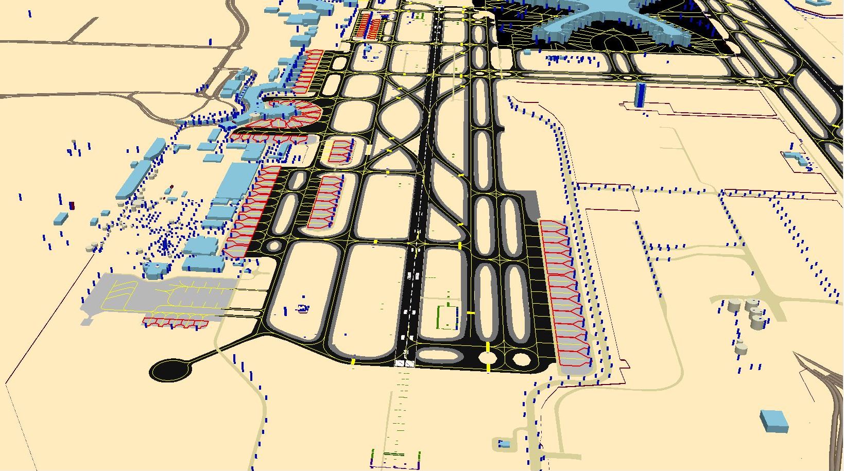
One of the major block upgrades within ICAO guidelines is the transition from AIS to AIM systems, which includes development of Integrated Aeronautical Information Database. Every aerodrome operator has the responsibility to provide data for obstacles and terrain in eTOD (electronic Terrain and Obstacle data) format and it is one of the compliances according to provisions of ICAO Annex 15.
RTech has developed a solution that supports the operators and the State to develop this framework and to comply with the given guidelines. Development of eTOD data is not just survey or capturing the data but further looks into deploying this data in the SWIM systems. With proprietary algorithms, RTech has devised solutions that include end-to-end seamless data integration along with the publication of this data through eAIP.
RTech:eTOD uses various techniques for data capture such as LIDAR Survey, Topographical Survey, use of existing digitized datasets etc. This data is further processed using the integrated tool that RTech has developed for Data Processing which ensures that data integrity and accuracy is maintained throughout its lifecycle.
RTech:eTOD helps in development and implementation of terrain, obstacles and aerodrome mapping databases.